Digital Twins for Smart Rural Places: Wyoming Communities into the Future

Can a “Digital Twin” Support Small Town Decision-Making?

Researchers at the University of Wyoming are studying how new technology can help small towns in Wyoming plan for the future — and whether citizens want it.

University of Wyoming·IRB Protocol #IRB-2026-44

Split illustration of a small-town Wyoming main street. On the left, the real street with a car and a pedestrian. On the right, the same street as a digital-twin wireframe model where the car becomes a plain box and the pedestrian a stick figure. CAR REAL STREET DIGITAL TWIN
1

What Is a Digital Twin?

Imagine a video game version of your downtown that uses information from sensors to show what’s happening in real time. The combination of 1) sensors picking up data (a camera is an example of a sensor), 2) a computer program that produces usable information from the sensor data (such as a count of open parking spots), and 3) a means for you to use that information to make plans (in this case, a live video game view of the street showing you whether or not you’re likely to get a parking spot if you leave now), is basically what a digital twin is.

Animated illustration: a top-down map of a small downtown with cars moving along the streets and parking spaces changing between open and taken. PARKING LIVE VIEW Green = open spot · Red = taken
Illustration: a digital twin shows a live, simplified view of the street: moving traffic and which parking spots are open.

City planners can use a digital twin model to answer questions such as:

  • Does traffic flow differently during a busy lunch hour versus a Saturday night?
  • Is there enough parking to serve new businesses?
  • Does the current placement of stop signs enhance pedestrian safety?
  • Which streets should be repaired first?
2

What Is This Project About?

This project is testing the use of digital twins to find out whether they could be useful in small towns in Wyoming — and whether the people who live there actually want them.

Big cities like New York and Los Angeles already use this kind of technology to look at patterns of activities such as vehicle and pedestrian use of public spaces during special events or the timing of lights during rush hours, and to plan for long-term growth and change. But small towns are different. They have smaller budgets, fewer staff, and different needs. We want to know: Can we build an affordable and useful digital twin model that works for smaller Wyoming towns like Afton or Laramie?

We are working in two Wyoming cities right now:

  • Laramie, WY
  • Afton, WY
Map of Wyoming with pins marking the two study sites: Afton, on the western border, and Laramie, in the southeast. WYOMING Laramie Afton pop. ~2,000
The two study sites: Laramie and Afton, Wyoming.
3

How Does It Work?

We set up small cameras in public areas — like downtown streets or parking areas. These cameras count things like cars and people walking by.

The video from the cameras is collected on a secured computer server on the University of Wyoming campus and is processed by software that automatically replaces images of vehicles and people with a standard shape over a car and a simple stick figure shape over an image of a person, so that neither can be identified in camera images. Once the images of vehicles and pedestrians have been replaced by these shapes, the original video is deleted.

Photo coming soon A small, unobtrusive camera mounted on a street pole or building corner, with a posted sign visible nearby. images/camera-pole.jpg
A small study camera mounted on a street pole, with a study sign posted nearby.
Three panels. First, what the camera sees: a blurry person on a sidewalk and a car. Second, the software replaces them with a stick figure and a plain car shape. Third, what we keep: only bar-chart counts of cars and people. What the camera sees Processed on a secure UW server CAR Replaced with shapes Then the original video is deleted MorningMiddayEvening Cars People What we keep Just counts and patterns
Illustration: from camera image to anonymous counts. The bar chart is an example, not real study data.

The data we extract helps us answer questions like: How many cars park downtown on a Tuesday? Do people walk more in the morning or the afternoon? Where do traffic jams happen?

No names. No faces. No license plates. Just counts and patterns.

4

How Are We Learning From People?

Computers can count cars — but they can’t tell us what people think. So we’re collecting data in two additional ways:

Interviews with city leaders and experts

We are interviewing people who work in city government, planning, and infrastructure — like town administrators, public works directors, and emergency managers — to learn about their current approach to short-term and long-term planning and to find out what types of data they’d like to have access to, what they’d like to know about how the people in their town use public spaces, whether they think the data being produced in this Digital Twin Study could be useful to them, and what challenges they might face in adopting a digital twin model.
A survey of Wyoming adults

We’re also reaching out to people living throughout Wyoming and asking them to complete a survey which will help us to understand what people think of this type of technology, whether they’d trust their city leaders to use the data appropriately, and whether they think it could help their town to provide better services to its citizens.

5

What About Privacy?

We know that cameras in public spaces can make people uncomfortable. We take that seriously and want you to feel that you can use these spaces as you usually do, without sacrificing your privacy:

Here’s how we protect your privacy:

  • A sign is posted at each camera location to let you know where the cameras that are associated with this study have been placed.
  • We will not save raw pictures of you. Our software replaces every person with a plain outline shape before we use the footage for this study.
  • We also replace images of each vehicle with a plain car outline. No license plates, colors, or identifying details are kept.
  • The original video is permanently deleted once we confirm that identifiable images have successfully been replaced with anonymous shapes.
Illustration of a study notification sign on a street pole reading: Research in Progress, No Faces Recorded, University of Wyoming Digital Twin Study, with a space for a QR code. RESEARCH IN PROGRESS No Faces Recorded University of Wyoming Digital Twin Study Scan to learn more → QR
A sign like this is posted at every camera location (illustration).
6

Why Does This Matter?

Small towns across Wyoming — and rural America — often get left out when new technology comes along. The tools get built for big cities, and small towns either can’t afford them or they don’t fit.

We think that’s a problem worth fixing. If we can show that a simple, affordable digital twin can help a place like Afton (population ~2,000) plan its streets and parking better, that knowledge could help hundreds of small towns across the country.

Photo coming soon A wide scenic photo of a small Wyoming town: mountains in the background, main street in the foreground (Afton or Laramie). images/town-landscape.jpg
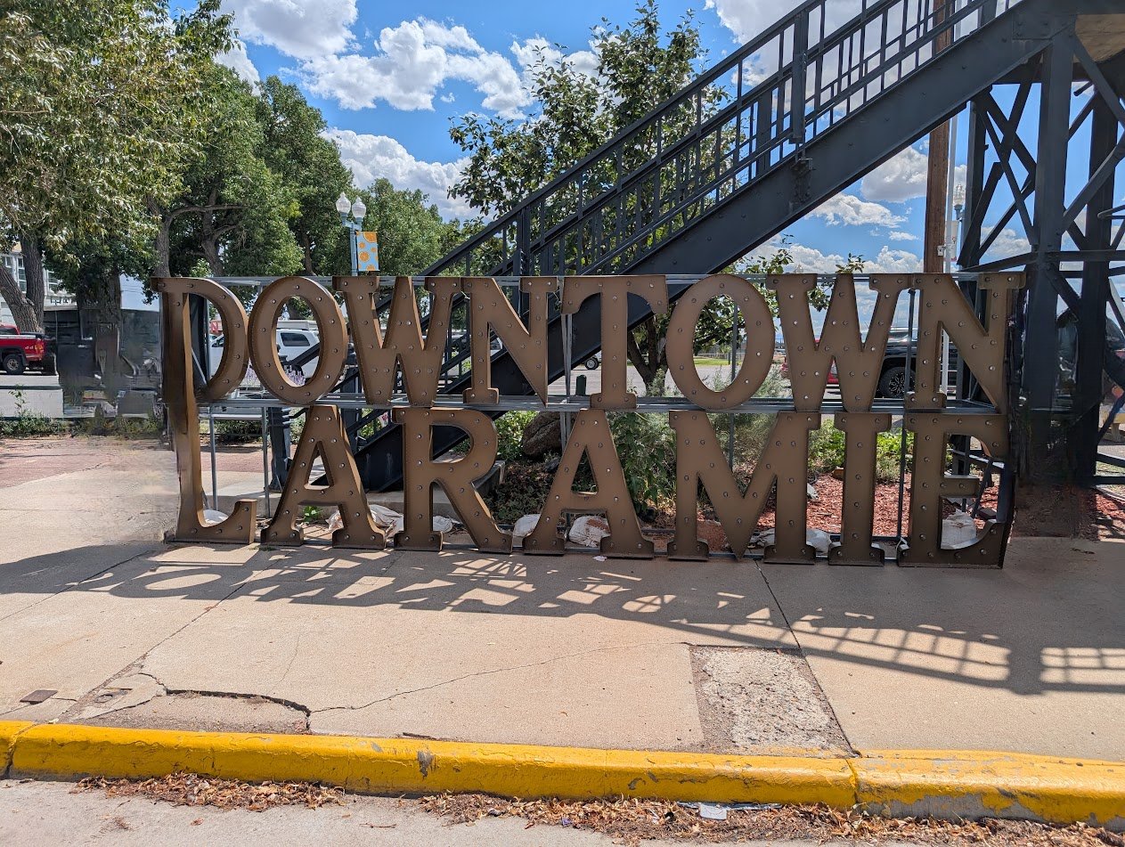
The “Downtown Laramie” sign on a sidewalk in downtown Laramie, Wyoming.

We are also asking whether people want this — because technology is only useful if communities trust it and choose to use it. That’s why the survey and the interviews are just as important as the cameras.

7

Who Are We?

This project is led by researchers at the University of Wyoming. The team includes computer scientists, social scientists, and community researchers.

JH

Jason (Jake) Hawes

Principal Investigator · School of Computing & Haub School, UW

VL

Vanessa Lueck

Human Factors · School of Computing, UW

JN

Judith Nkechinyere Njoku

Digital Twin Development and Visualization · School of Computing, UW

VK

Vinit Katariya

Camera AI Algorithms · School of Computing, UW

DS

Diksha Shukla

Digital Twin AI Algorithms · EECS, UW

IH

Ismail Hossain

Interviews & Analysis · School of Computing, UW

JG

Jian Gong

Sensor Networks and Data Collection · School of Computing, UW

JH

Jeffrey Hamerlinck

Supervisor and Director – Center for Rural Community Resilience and Innovation

This research is funded by the University of Wyoming. It has been reviewed and approved by the UW Institutional Review Board (IRB Protocol #IRB-2026-44) to make sure it is conducted ethically and safely.

8

Common Questions

Can the cameras see me?

Automated AI algorithms will process the camera footage which will detect and track vehicle or person-shaped objects if they are present. The footage is kept for a short limited time at University of Wyoming’s secure servers for only the team members to improve the algorithms. Our software will de-identify the objects into plain silhouettes and no raw data will be shared with the public or the government. Raw videos will be deleted after the de-identification process.

Are you sharing this footage with the police or the government?

No. The camera data is used only for this research study. We do not share video footage with anyone outside the research team — and there is no identifiable video footage to share after our software processes it.

How do I know a camera is running near me?

We post signs at every location where cameras are active. Signs show the dates of data collection, a brief explanation of the study, and contact information so you can ask questions.

Can I participate in the survey or an interview?

The survey is open to adults living in rural areas of Wyoming and the American West. If you work in city planning, infrastructure, or a related field in Laramie or Afton, you may be contacted for an interview. Contact us below if you’d like to learn more.

What will you do with what you find?

We will publish our findings in academic journals and share them with the communities involved. Our goal is to help other researchers and city leaders understand whether and how this technology can work for small rural towns.

9

Get in Touch

Questions? We’d love to hear from you.

Jason (Jake) Hawes, Principal Investigator

jhawes@uwyo.edu · School of Computing, University of Wyoming

Questions about your rights as a research participant? Contact the UW IRB Administrator: 307-766-5320